Wednesday, 30 April 2025

Hebridean Way 30/04/25

Day 7. Wednesday 30th April 

I met an interesting group of kayakers / walkers in the excellent cooking / eating area at the campsite and I'm now thinking of joining their group!

Morning view

The weather was overcast and a bit windier than yesterday but it did brighten during the day. I decided to stay at Howmore hostel and climb the South Uist hills but it was too far for a days walk so today and tomorrow will be shorter.

Benbecula distillery, unfortunately closed when I passed.

I had an interesting discussion with someone who was putting up some fencing by the road, he had moved up with his family from Reading some years ago and was now making a living fencing, building bridges or the Hebridean Way, etc and definitely hadn't regretted the move.

The causeway to Benbecula 

Benbecula is very flat but it does have a little hill near the north that the Hebridean Way goes over. It was a great view of the 60% water that comprises the island.

Watery view of Benbecula 

The Way then heads for the airport and Balivanich which is largest population centre and even has two supermarkets as well as a restaurant for lunch.

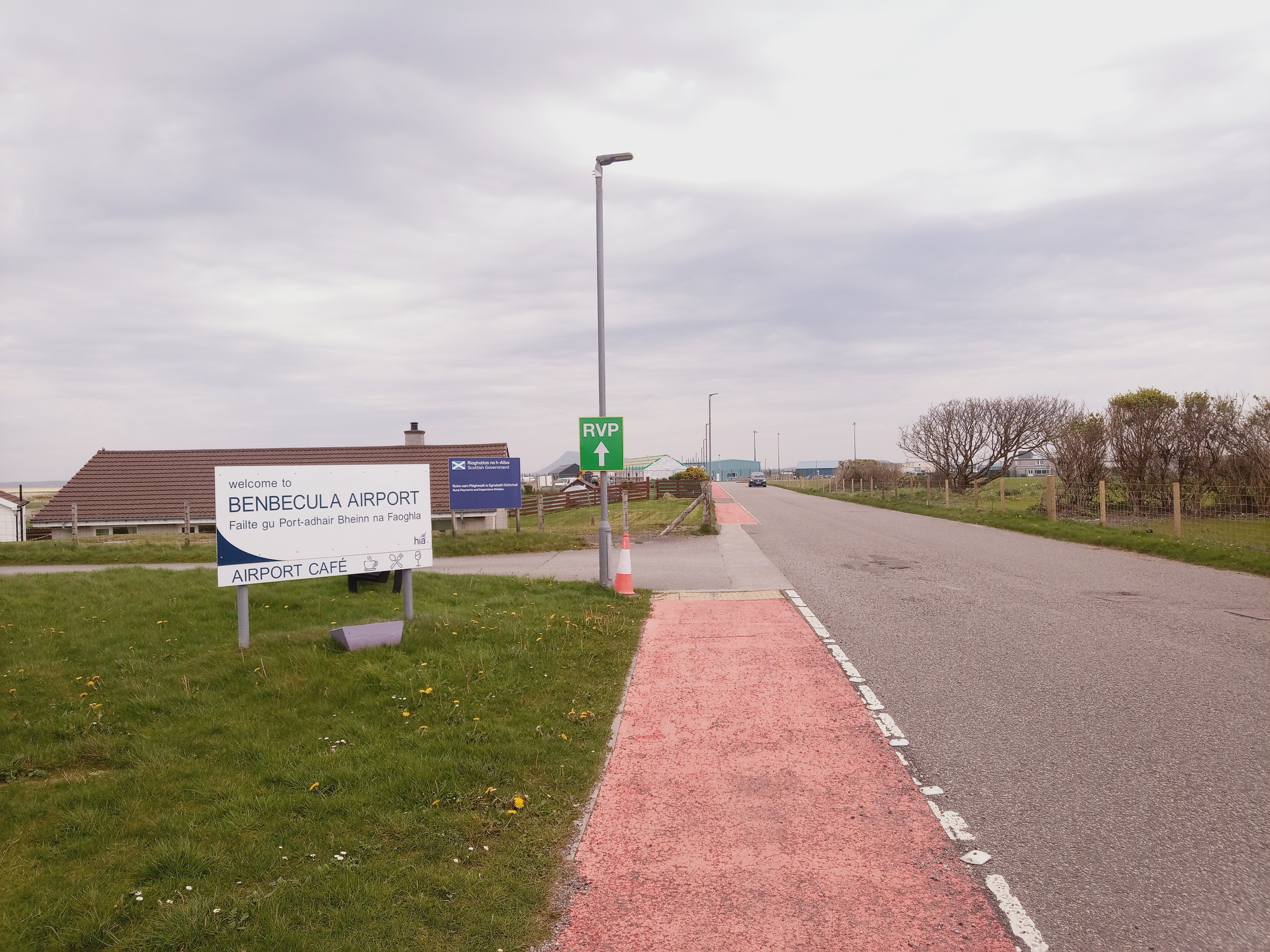
Not a major air terminal

It is a busy commercial place as it is in the middle of the connected chain of islands from Berneray to Eriskay but not somewhere I would wish to live.

Balivanich

There is a complete change of scenery then as the Way goes down the beautiful white sands of the west coast.

White shell sand beach

The campsite is close to the Dark Island Hotel so it seemed to be a good idea to treat myself to a non dehydrated evening meal. Very tasty it was too.

And there's more!


17 miles walked. 250 meters ascent

Hebridean Way 29/04/25

Day 6. Tuesday 29th April 

An excellent hostel last night, sitting round the stove with a nice peat fire. There were only two of us there, myself and a Swiss cyclist.

John's Bunkhouse 

There was a light overcast in the morning and there had been a little rain overnight but the forecast was good and the wind light.

Looking back to Berneray and the causeway 

The route crossed the causeway to North Uist and after a short road walk climbed over Beinn Mhor with some good views to the Sound of Harris but much better was to come with the view of the land-water mix ahead.

Land or water?

The area was truly beautiful with some perfect camping spots amongst the brackish water and only the sound of Curlew, Lapwing and Snipe until three Swans flew past in formation. It was magical.

Sea water

Unfortunately much too early to stop, so after taking time to watch a pair of Lapwings chasing off a marauding gull I emerged onto the road where I met a survey team using a drone to map out the line of a new water pipe, much easier than the old method.

Farewell to the tidal flats


I met several people walking the Way today, quite an international mix, some doing it slowly others not, but all south to north.

The island isn't quite sure if it is really land

I spent some time debating with myself whether it would be worth an extra mile of walking to go to and from the café in Lochmaddy but in the end decided against it and continued on the long road section. Most of this was on the old road that had been replaced so was good traffic free walking.

The old road 

There is actually a forest where I turned off the road, this had been planted by the forestry commission as a trial. it looked successful to me.

The Way around the forest

The hotel at Langais provided coffee and cake to keep me going for the rest of the afternoon on another boggy section to the campsite at Moorcroft.

More sea inlets

A really good day that required my sun hat in the afternoon and apart from a lot of very squelchy bog was an excellent walk.

Moorcroft campsite 


21 miles walked 500 meters ascent.


Tuesday, 29 April 2025

Hebridean Way 28/04/25

Day 5 Monday 28th April.

It was a seriously wet and windy night, typical Hebridean weather! I was happy to be inside the nice warm dry caravan.

Looking back to the caravan in the morning 

The weather had improved by morning and was reasonable all day, low cloud and drizzle at times but the wind had abated and apart from all the water underfoot it was pleasant walking today.

A bit misty but a good path

The route this morning was an old coffin road to the west coast, so called because there was no suitable ground in the east for a grave and coffins had to be carried over the hills to be buried in the west coast sands.

The coffin road

Visibility was poor with the cloud low on the hills but it was an excellent track and a lovely walk with cuckoos calling in the distance.

West side

When the path reaches the west coast the Hebridean Way climbs over a hill slightly inland, presumably to get the view of the white Luskentyre sands.

Very misty view ot the white sands

I suspect, however, that it is a little used section as there is no sign of a path and it was a very steep, wet climb and just as bad down the other side. The continuation didn't look any better so I decided to go down to the road as it would be a much more pleasant walk.

Down to the road

A little farther on I met a couple of walkers who had camped at Horgabost last night and had an "interesting" night. They were heading north and told me that they had tried an off road section of the way further south and their opinion was similar to mine.

Sands from the road

 The walk down the road was good and allowed me to call in to a community café for watery soup and a poor, overpriced sandwich.
Artisan mustard shop

Before Leverborough I came across "The Hebrides People Visitor Centre" which wasn't showing any signs of life but there was a sign that said 'coffee' so I thought I'd give it a try.
The Hebrides People Visitor Centre 

They did sell coffee but mainly they had a masses of information about the history of the Hebrides and it's people, genealogical records and a huge selection of books about the islands, I must go back sometime with a large book carrier.

Leverborough

I got to the ferry terminal in time to go to the Harris Brewery shop and restaurant and get a takeaway to eat on the ferry before arriving at Berneray and the incredible John's Bunkhouse which I would highly recommend .

Berneray ferry


20 miles walked. 700 meters ascent.

Monday, 28 April 2025

Hebridean Way 27/04/25

Day 4 Sunday 28th April 

Last night was very comfortable despite being woken up at one stage by the wind and rain battering the tent, but I don't think it lasted that long.

On the road again

It was a very nice morning when I packed up and carried on along the road.  I had thought that maybe I would try a couple of hills today but the cloud was very low and the forecast lousy.

Tennis court in n the middle of nowhere 

The weather slowly deteriorated during the morning and by the time I arrived in Tarbert. it was raining steadily. At least the hotel was open for lunch, everything else in Lewis and Harris is closed for the Sabbath.

Remains of the last whaling station in Britain 

I thought it would be nice to stay in the hostel but it was full, so after a quick look at Air BnB I found a caravan at Greosahbaigh that was reasonably priced.

Harris Hotel

I headed into the steadily increasing wind and rain and was glad to arrive as by that time the wind and rain were really howling round the caravan.

Off the road for a while

Camping in this area is almost impossible as the ground is either rock, under water, nearly underwater, or wet and covered with heather. Given the lack of shelter, good luck to anyone who tries it!

Camping?


18.5 miles walked. 700 meters ascent 

Hebridean Way 26/04/25

Day 3, Saturday 26th April

A dull drizzly start to the day with the strong southerly wind, at least it wasn't cold.

Harris hills in the distance

A few more miles down the road until I turned off to Loch Morsgail and the start of the way over to Kinloch Resort.

Road to Loch Morsgail 

There is a tarred road as far as the Loch and Lodge but after that the path becomes a line by the river and after crossing the non existent footbridge is just some marker stones and posts in the bog.

Looking back to Loch Morsgail Lodge

There was no sign of a path and I had to try and find a way in the correct general direction without getting stuck in the peat hags or generally vanishing into the bog.

Old Sheiling 

I did slip in a peat hag at one point and my walking pole sunk into the sticky depths but as I was still moving forward I now have one bent pole!

More miles of bog

There is a little, rather dilapidated, bothy at Kinloch Resort which had a rather rusty camping Gaz stove with gas but I didn't stop and carried on across the easy river crossing and up through the genuinely pathless, wet boggy ground to Loch a' Cheibhle and the impressive overhanging rockface of Sron Uladial, which is said to be the highest overhanging cliff in the British Isles.

Sron Uladial in the distance 

There is a good path from the loch up Gleann Uladial and my plan was to camp near the top of the pass and climb a few hills but the weather had other ideas. There were clouds hanging about on the tops but the sun had been trying to appear after the drizzle went away, so far so good but the wind was another matter.

Looking up Gleann Uladial 

It may have been possible to pitch the tent somewhere in better conditions, but there was no shelter whatsoever and the wind was coming over the beach at near gale force.

Looking down Gleann Uladial 

I had to take the sensible option and come down the otherside hoping to find some shelter.

Gleann Chliostair 

I arrived at the road and still hadn't found anywhere suitable but a short distance along  I saw a little green patch by a lochan that looked reasonably sheltered and it was. The sun even shone as I was putting up the tent.


20 miles walked 650 meters ascent.